Showgrounds Map
Use the current aerial map and key below to plan where key activities are located.
Aerial Map
Showgrounds overview
The map image is provided as a static file so it can be replaced easily for future show years.
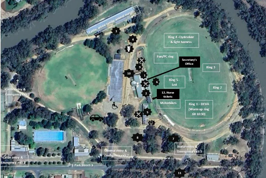
Map Key
Numbered locations
- LEGO, Photography, market stalls, inside Multipurpose rooms.
- Joan Harding Art Competition in change room 1, FIRST AID in change room 2.
- Mini train rides
- Angling club BBQ
- Ladies Pavilion – cookery, produce, school displays.
- Official opening, Show Quest, pet parade
- Ferguson tractors
- Truck/machinery display, traders.
- Black snake
- Showbags, rides & market stalls
- Ploughing displays
- Horse tickets and facepainting; toilets and disabled toilets inside multipurpose rooms; food parking on the left-hand side of the main entrance; disabled parking at the end of the netball courts.
Locations subject to change.